A practical guide to Tenerife in Spain: Mount Teide and the cable car, why the island has snow and beaches at once, when to go, the north and the south, Masca, Los Gigantes, whale watching and where to stay.
Tenerife is the largest of Spain’s Canary Islands, an archipelago off the northwest coast of Africa. It covers about 2,034 square kilometres, has roughly 342 kilometres of coastline and a population of about 974,000, and it received more than 7.3 million tourists in 2024.
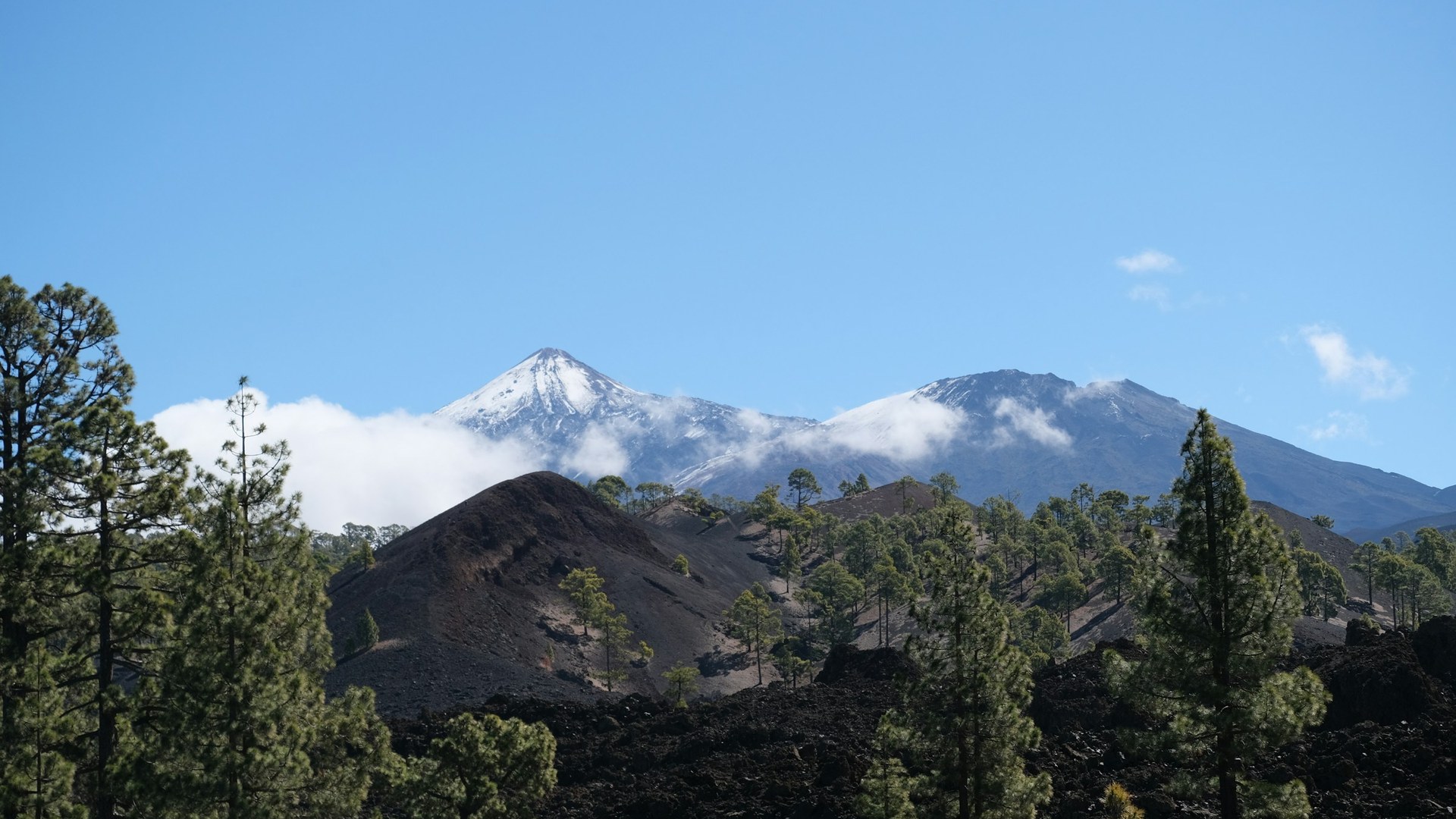
The island is dominated by Mount Teide, which Spain’s national geographic institute puts at 3,715 metres, the highest point in Spain. Many sources quote 3,718 metres, so you will see both figures. Measured from the ocean floor, Teide climbs roughly 7,500 metres. That height is the reason the island has beaches on the coast and snow on the peak in the same winter.
Our short Tenerife video is below. For the quick version, see our Tenerife travel guide.
Teide is a volcano in the middle of the island. Its last eruption in the area was in 1909, at El Chinyero. Teide National Park was declared a national park on 22 January 1954, covers about 189.9 square kilometres and became a UNESCO World Heritage Site on 28 June 2007. It is one of the most visited national parks in Europe, with 4,463,281 visitors in 2023.
You may read that Teide is the third-tallest volcanic structure on Earth. That ranking only works if Hawaii’s volcanoes are counted as one structure, so we treat it as a claim with a caveat, not a plain fact. The better-supported number is the roughly 7,500 metres from the ocean floor to the summit.
Weather up high is a separate world. The caldera receives less than 500 millimetres of precipitation a year, and about a third of it falls as snow. The Izaña observatory at 2,371 metres has a January average high of about 7.5 °C, while the coast can be more than 20 °C. Bring layers and sun protection even in winter.
The Teide cable car runs from about 2,356 metres to the La Rambleta station at about 3,555 metres. The ride takes roughly 8 minutes, and cabins carry up to 38 passengers, or 34 in high wind. Wind and weather can suspend service, so check conditions on the day and keep your plans flexible.
From La Rambleta, the final stretch of about 160 to 200 metres to the summit crater needs a permit. Sources disagree on whether it is free, and rules and fees change, so do not rely on us for the price. Check Tenerife ON, the official booking site, and book ahead for busy periods. One tour operator reports that time slots run through the day and that without a permit you can stay only a short time at the upper station, so treat those details as something to confirm.
These are our own suggestions, not official advice.
Tenerife is often called an island of year-round spring, but the weather depends on where you are. On the coast, winter temperatures are typically 18 to 20 °C and summer temperatures 24 to 26 °C. In Santa Cruz de Tenerife, the January mean maximum is about 21.5 °C and August about 29.7 °C, with around 209 millimetres of rain a year and about 2,998 hours of sun.
The island has a clear wet side and dry side. The north and northwest catch more cloud and rain, while the south and southeast are drier. Tenerife South Airport has a January average high of about 22.8 °C and about 119 millimetres of rain a year, while La Laguna in the north has about 517 millimetres. If your priority is beach weather, the south is the safer bet. If you want green hills and hiking, the north is better, with the trade-off of more cloud.
Snow on Teide is mainly a winter and early spring sight, and you can often see it from the coast on a clear day.
Most first-time visitors choose a base by what they want from the trip.
Santa Cruz de Tenerife, the capital, is on the northeast coast. Its Carnival is a Festival of International Tourist Interest. If you plan to visit during Carnival, book accommodation well ahead.
Tenerife has many beaches, from volcanic coves to resort beaches. The south coast is the main beach holiday area, and conditions vary: some beaches have calm water and some face open Atlantic swell, so follow the flags and ask local lifeguards where it is safe to swim.
Los Gigantes on the west coast is known for its sea cliffs, which rise up to about 500 metres above the water. Boat trips from there are a common way to see them from below. We cannot verify every beach rule here, so check local signs on the day.
The Masca gorge is one of the island’s best-known hikes. Sources describe it as about 5 kilometres one way and roughly 6.5 hours for the round trip with a boat return option, with around 650 metres of elevation change. It is for experienced walkers in proper footwear, and access is regulated with booking and an entry fee, so check the current rules before you go. We will not quote the price, since it changes.
One tour source says a boat can bring you back to Los Gigantes and that there is a daily visitor cap and a minimum age, but we have only seen that in a single source, so confirm it with the official booking page.
Near Icod de los Vinos, the Cueva del Viento is a lava-tube system more than 17 kilometres long. It is the largest lava-tube system in Europe and the sixth largest in the world, formed by lava from Pico Viejo, and it has three levels. Visits depend on guided access, and we could not verify current tour details, so check with a local operator before planning around it.
Whale and dolphin boats leave from Puerto Colón in Costa Adeje. The Teno-Rasca area was recognised in January 2021 as Europe’s first Whale Heritage Area. Choose an operator that follows responsible-viewing rules, keep your distance, and expect the sighting to be a chance, not a guarantee.
Tenerife has two airports, Tenerife South and Tenerife North. Many visitors arrive at the south airport for the beach resorts. Island buses are run by TITSA, and the Tenerife Tram connects Santa Cruz with La Laguna. A rental car makes the national park, Masca and the north much easier to combine.
Mountain roads are narrow with sharp bends, so allow more time than the distance suggests, and check road and weather alerts before you drive to the park.
For a beach holiday, the south around Los Cristianos, Playa de las Américas and Costa Adeje has the most hotels and the best chance of sun. For hiking, forest and a more local feel, Puerto de la Cruz in the north is a better base. If you want to explore Teide at sunrise or sunset, some travellers stay near the national park, but options there are limited, so book early.
Entry rules depend on your passport, so check the official Spanish rules for your nationality, including whether you need a visa and how long your passport must be valid. Spain is in the Schengen Area, and the Canary Islands follow Spanish immigration rules, but customs and tax rules can differ from the mainland, so check those too.
This is our own suggestion, not an official itinerary.
The national geographic institute of Spain gives 3,715 metres, which makes it the highest point in Spain. Many sources use 3,718 metres. From the ocean floor it climbs roughly 7,500 metres.
Yes, on Teide. Snow falls mainly in winter and early spring, while the coast stays mild. The Izaña observatory at 2,371 metres has a January average high of about 7.5 °C.
The final stretch from the top cable car station to the summit needs a permit. Rules and fees change, so check Tenerife ON before you go.
About 8 minutes, from roughly 2,356 metres to the La Rambleta station at about 3,555 metres.
The coast is mild all year, about 18 to 20 °C in winter and 24 to 26 °C in summer. The south is drier and sunnier, and the north is greener and wetter.
The south is better for beaches and sun, with resorts around Los Cristianos, Playa de las Américas and Costa Adeje. The north is greener and has Puerto de la Cruz and the Anaga mountains.
Boats leave from Puerto Colón in Costa Adeje. The Teno-Rasca area was recognised as Europe’s first Whale Heritage Area in January 2021.
It is a demanding hike of about 5 kilometres one way with around 650 metres of elevation change, and access needs booking. It is for experienced walkers.
A lava-tube system near Icod de los Vinos, more than 17 kilometres long. It is the largest in Europe and the sixth largest in the world.
It depends on your passport. Check the official Spanish rules for your nationality, since the Canary Islands follow Spanish immigration rules.
Most beach holidays are based in the south, around Los Cristianos, Playa de las Américas or Costa Adeje. Compare prices and reviews, and check the cancellation terms before you reserve.
See stays in Tenerife on Booking.com →
Some links on this page are affiliate links. If you book through them, Letsa Atlas may earn a small commission at no extra cost to you.
We checked this guide on November 8, 2026. Prices, hours, permits and entry rules change. We checked the practical details on 10 November 2026. Confirm them with the official Teide cable car site, Tenerife ON and your own government before you travel. Confirm details with official sources before you go.
Sources checked November 8, 2026: Wikipedia: Tenerife · Wikipedia: Teide · UNESCO: Teide National Park · Wikivoyage: Tenerife · Tenerife ON