Travel › Spain › Tenerife
Letsa Travel · Spain

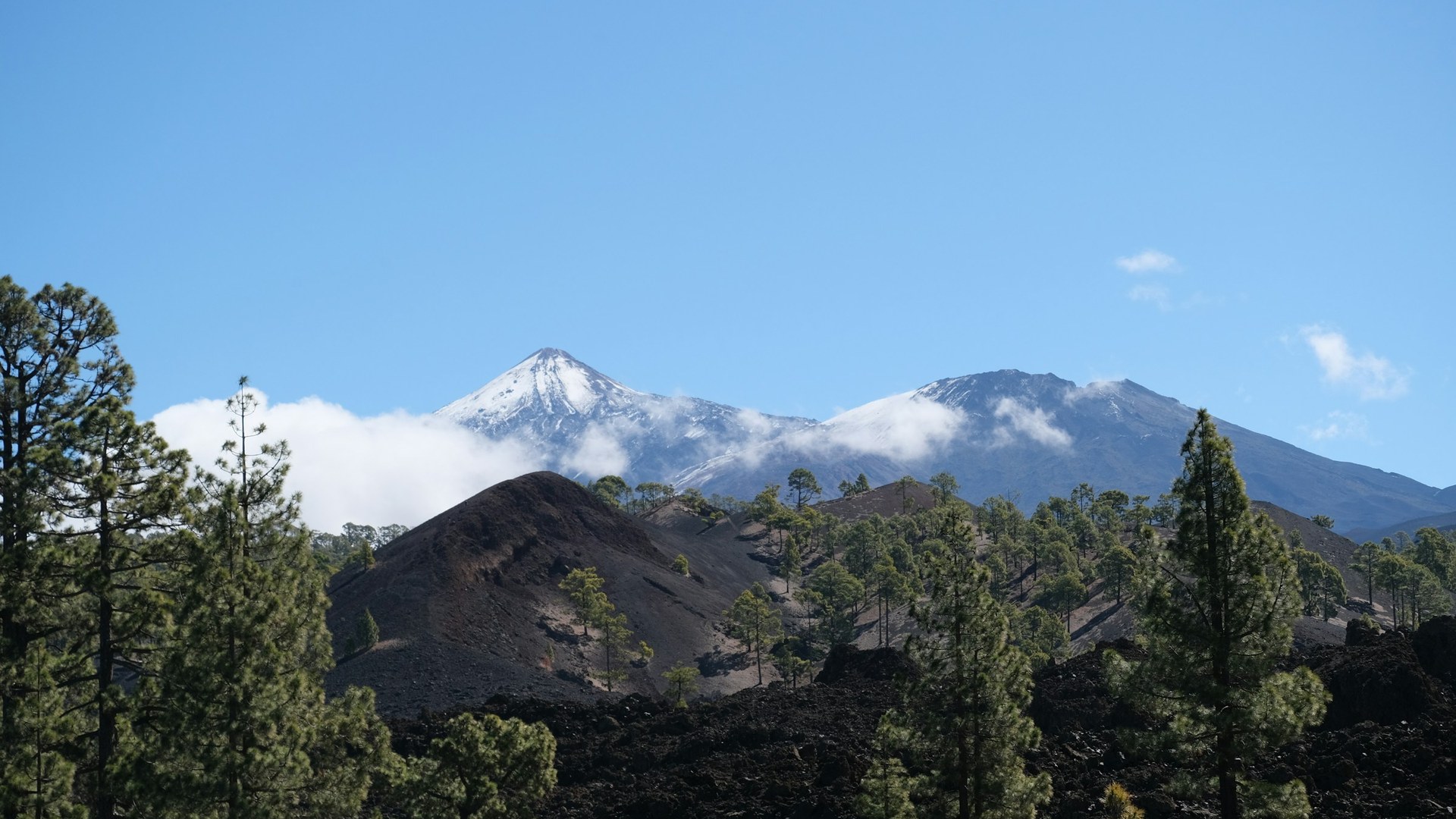
Tenerife: Spain's highest peak rises above a beach island and often wears snow in winter

Tenerife, the largest of Spain's Canary Islands, is a beach island with a volcano on it: Mount Teide reaches 3,715 meters, so you can swim on the coast and see snow on the peak in the same winter.

The story

A beach island with Spain's highest mountain

Tenerife is the largest island of the Canary Islands, an archipelago off the northwest coast of Africa that belongs to Spain. It covers about 2,034 square kilometers, has roughly 342 kilometers of coastline and welcomed more than 7.3 million tourists in 2024.

At the center rises Mount Teide, a volcano whose summit is 3,715 meters above sea level according to Spain's national geographic institute. That makes it the highest point in Spain. Measured from the ocean floor, it climbs roughly 7,500 meters. The last eruption in the area was in 1909, at El Chinyero, and Teide National Park became a UNESCO World Heritage Site in 2007.

That height is why the island has two climates at once. Coastal temperatures stay mild in winter, around 18 to 20 °C on the coast, while the high caldera gets cold: the Izaña observatory at 2,371 meters has a January average high of about 7.5 °C, and roughly a third of the little precipitation up there falls as snow.

3,715 mMount Teide, the highest point in Spain
≈7,500 mheight measured from the ocean floor
18–20 °Ctypical winter temperatures on the coast

From our Letsa Atlas Short · Watch on YouTube

Practical guide

Plan your Tenerife trip

Check before you go: Entry rules for Spain depend on your passport, so check the official rules for your nationality before you book. Access to the very top of Teide needs a permit, and the rules, fees and cable car conditions change, so check Tenerife ON and the official cable car site. We have a longer guide with weather by region and a 3-day plan.

When to go

  • The coast is mild all year: roughly 18 to 20 °C in winter and 24 to 26 °C in summer, according to climate data. The north and northwest are wetter, while the south and southeast are drier and sunnier. Snow on Teide is a winter and early spring sight, so bring layers if you go up.

North or south

  • The south has the main beach resorts around Los Cristianos, Playa de las Américas and Costa Adeje. The north is greener and wetter, with Puerto de la Cruz and the Anaga mountains, a UNESCO Biosphere Reserve since 2015.

Teide and the cable car

  • The cable car climbs from about 2,356 meters to La Rambleta at about 3,555 meters in roughly 8 minutes. The last stretch to the summit needs a permit, and wind can close the cable car, so check conditions on the day.

More to see

  • Los Gigantes has sea cliffs up to about 500 meters high, and whale and dolphin boats leave from Puerto Colón in Costa Adeje. The Masca gorge is a long, demanding hike that needs booking, and the Cueva del Viento near Icod de los Vinos is Europe's largest lava-tube system.

The photo above shows Mount Teide with snow above the clouds. The Short also shows the beaches, the cliffs and the caves. We checked on November 10, 2026. Entry rules, fees and prices change, so confirm them with official sources before you reserve.

Want the full picture? Read our complete Tenerife travel guide: Teide permit, weather by region, north versus south, Masca, whale watching and where to stay.
Where to stay

Find a place to stay

Tenerife is the easiest base for this trip. Compare prices and reviews, and check the cancellation terms before you reserve.

See stays in Tenerife on Booking.com →

Some links on this page are affiliate links. If you book through them, Letsa Atlas may earn a small commission at no extra cost to you.

Sources checked November 10, 2026: Wikipedia: Tenerife · Wikipedia: Teide · UNESCO World Heritage: Teide National Park · Wikivoyage: Tenerife