A practical guide to Lauterbrunnen in Switzerland: the valley of 72 waterfalls, Staubbach and Trümmelbach Falls, the car-free villages of Wengen and Mürren, Schilthorn and Jungfraujoch, when to go, how to get around and where to stay.
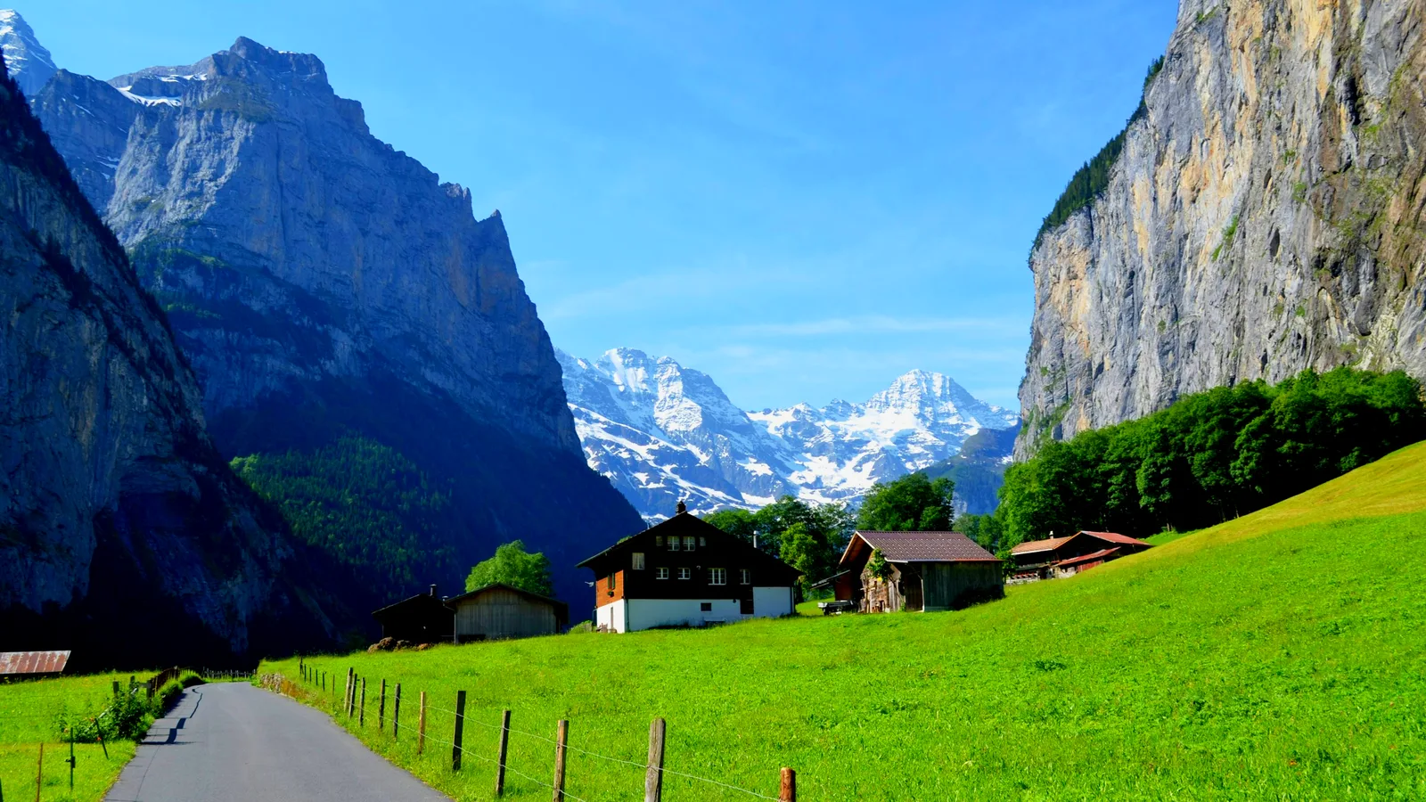
Lauterbrunnen is a village of about 2,300 people in the Bernese Oberland of Switzerland, at roughly 802 metres above sea level. It sits in a narrow, glacier-carved valley that is rarely more than a kilometre wide, between rock walls that rise up to about 1,000 metres. The Jungfrau Region tourism site counts 72 waterfalls in the valley, which is why it is often called the valley of 72 waterfalls.
You can see the main sights in a day: Staubbach Falls beside the village, the Trümmelbach Falls inside the mountain, and a ride up to Wengen or Mürren for the views. Two or three days gives you time for a high-mountain trip as well. Switzerland is among the more expensive countries to visit, and Lauterbrunnen has limited rooms, so the best plan is to book early and keep your timetable flexible for weather.
Our short Lauterbrunnen video is below. For the quick version, see our Lauterbrunnen travel guide.
Lauterbrunnen is a classic U-shaped glacial valley. Ice carved it into a flat floor with near-vertical walls, and when the glacier melted it left side valleys hanging high above the floor. Streams from those hanging valleys now fall straight off the cliff edge, which is what produces so many waterfalls in such a short stretch. The name is usually explained as “nothing but fountains”, a nod to the water on every side.
The valley is rarely more than a kilometre wide, and the cliffs on both sides reach up to about 1,000 metres. In a place this narrow, sunlight is short in winter and the walls feel closer than the numbers suggest. The Swiss Alps Jungfrau-Aletsch area nearby is a UNESCO World Heritage Site, and the valley is the gateway to the high peaks of the Jungfrau massif.
The author J. R. R. Tolkien walked into the valley from Interlaken in 1911, and the landscape is often linked to the hidden valley of Rivendell in his books. That is a literary connection, not an official attraction, but it explains why the valley feels familiar to many first-time visitors.
The figure of 72 comes from the Jungfrau Region tourism site, and counts depend on how small streams and seasonal falls are treated, so treat it as the standard local count and not a precise survey. The best known falls are Staubbach, near the village centre, and the Trümmelbach Falls, inside the mountain. Others include Mürrenbach, which is cited as one of the tallest in Switzerland, as well as Spissbach, Staldenbach and Holdri.
Water volume changes a lot with the season. Late spring and summer carry the most meltwater, while in dry spells or deep winter some falls shrink to a trickle or freeze. If waterfalls are the main reason you are coming, plan for May to September and expect crowds.
Staubbach Falls drops about 297 metres from a cliff just behind the village, and it is described as the highest free-falling waterfall in Switzerland. Tourism sources often round it to 300 metres. The water breaks into spray before it reaches the bottom, and the name means “dust stream”.
You can see it from the valley floor with no ticket and almost no walking. A short path leads to the base, and a gallery cut into the rock lets you look at the falls from behind, but paths can be wet, closed in winter or restricted for rockfall, so check the signs on the day. Early morning is quieter than midday, when tour groups arrive.
The Trümmelbach Falls are ten glacier-fed waterfalls that run inside the mountain, in a gorge the water has cut over thousands of years. They can carry up to 20,000 litres of water per second, and a tunnel lift takes visitors up inside the rock to walkways along the falls. The noise and spray are intense, so wear a waterproof layer and shoes with grip.
The official site says the falls are generally open daily from the beginning of April to November, 9:00 to 17:00, and 8:30 to 18:00 in July and August, depending on the weather. Babies, children under 4 and dogs are not allowed because of the safety risk. Opening dates and prices change, so check the official site before you go and do not plan a winter visit around them.
Wengen and Mürren sit on shelves high above the valley floor on opposite sides. Both are car-free: you reach Wengen by the rack railway from Lauterbrunnen, and Mürren by a cable car up to Grütschalp and a short train, or from Stechelberg by cable car via Gimmelwald. Check current timetables, because lifts close for maintenance and bad weather.
Wengen is on the sunny side, with views across to the Eiger, Mönch and Jungfrau, and it is the base for the Lauberhorn ski races. Mürren faces the same mountains from the other side and is the starting point for the cable car to the Schilthorn. Gimmelwald, between them, is a small farming village that is quieter and cheaper than its neighbours.
The Schilthorn cable car runs from Mürren to the summit, where the revolving restaurant Piz Gloria looks out over the Eiger, Mönch and Jungfrau. The summit is about 2,970 metres high. It is a good option if the Jungfraujoch is too expensive for your budget.
The Jungfraujoch is reached by the Jungfrau Railway, a rack line of about 9 kilometres that starts at Kleine Scheidegg and opened in 1912. The station sits at about 3,454 metres and is Europe’s highest railway station. You change trains in Lauterbrunnen or Grindelwald and again at Kleine Scheidegg. It is one of the most expensive excursions in Switzerland, so check the ticket price and the weather forecast before you commit, because clouds can hide the view entirely.
At these heights the air is thin and the weather is serious. Dress in layers, protect against the sun and take it slowly if you feel unwell.
The easiest walk is along the valley floor from Lauterbrunnen towards Stechelberg, a flat path that passes meadows, farms and several waterfalls. For more height, a trail climbs to Wengen and Mürren, and the cliff-top path between Mürren and Gimmelwald is a popular short walk with open views.
These are our own suggestions, not official advice.
Lauterbrunnen is one of the best-known BASE jumping places in the world, and you may see jumpers leave the cliffs or watch the canopies land in the meadows. There are legal jump points, and jumpers are required to hold a landing card from the Swiss BASE Association, but the sport is dangerous and fatalities happen every year.
As a visitor, the safe choice is to watch from a respectful distance. Stay off private fields, do not fly a drone near jumpers without checking the current Swiss drone rules, and never treat it as a casual activity to try.
Late spring and summer are the main season. Snow and glacier melt feed the waterfalls, the lifts and the Trümmelbach Falls are open, and the high trails clear of snow by early summer. It is also the busiest and most expensive time, so book rooms well ahead.
Autumn is quieter, with clear days and larger gaps in opening hours as lifts begin their maintenance closures. Winter is a ski season for Wengen and Mürren, with snow in the valley and some attractions closed. Early spring can be muddy and uncertain for higher routes. Whenever you go, check the weather and lift status the day before.
Most visitors arrive by train. Lauterbrunnen is on the Berner Oberland Bahn line from Interlaken, a short ride of roughly 20 minutes, and the Wengernalpbahn continues from Lauterbrunnen to Wengen, Kleine Scheidegg and Grindelwald. Interlaken connects to the rest of the Swiss rail network, and Zurich and Geneva are the main international airports. A Swiss rail pass can cover some of these lines, but not all mountain railways, so check what is included before you buy.
You can drive to Lauterbrunnen, but Wengen and Mürren are car-free, parking in the valley is limited and fills up in summer, and the train is usually easier. Within the valley, a local bus runs to Stechelberg and the trailheads, and many sights are within walking distance of the station.
Lauterbrunnen village is the practical base: you can walk to Staubbach Falls and the station, and have bus and train connections in every direction. Wengen and Mürren are quieter and have the better views, but cost more and need a lift ride with your luggage. Gimmelwald is a small, simple option. In summer rooms in the valley sell out early, and Interlaken is a fallback with more choice and a short train ride away.
Entry rules depend on your passport, so check the official Swiss rules for your nationality, including whether you need a visa and how long your passport must be valid. Switzerland is in the Schengen area but not the EU, so customs and tax rules differ from EU countries; check those as well. The currency is the Swiss franc, and card payments are widely accepted, but small mountain huts may still prefer cash.
This is our own suggestion, not an official itinerary.
The Jungfrau Region tourism site counts 72 waterfalls in the Lauterbrunnen Valley. The best known are Staubbach Falls, which drops about 297 metres beside the village, and the Trümmelbach Falls inside the mountain.
About 297 metres, which is described as the highest free-falling waterfall in Switzerland. Tourism sources often round it to about 300 metres. It is visible from the village and a short walk away.
Ten glacier-fed waterfalls inside the mountain, reached by a tunnel lift, carrying up to 20,000 litres of water per second. The official site says they are generally open from early April to November, and that babies, children under 4 and dogs are not allowed.
Late spring and summer have the strongest waterfalls and the most open lifts, and also the biggest crowds. Winter is for skiing around Wengen and Mürren, and some valley attractions are closed. Check timetables for the dates you plan to travel.
By train: Lauterbrunnen station is on the Berner Oberland Bahn from Interlaken, with the Wengernalpbahn continuing to Wengen, Kleine Scheidegg and Grindelwald. Wengen and Mürren are car-free, so you reach them by rail or cable car.
There are legal jump points, and jumpers need a landing card from the Swiss BASE Association, but the sport is dangerous and deaths happen every year. It is not an activity for visitors without specialist training; watching is the safe choice.
Yes if you come for snow, skiing at Wengen or Mürren and quiet valley walks, but the waterfalls carry less water and some attractions, including the Trümmelbach Falls, are closed. Check what is open before you plan around it.
It depends on your passport. Switzerland is in the Schengen area but not the EU, so check the official Swiss rules for your nationality, including how long your passport must be valid.
Two to three days lets you see the waterfalls, ride up to Wengen or Mürren and add one high-mountain trip such as the Schilthorn or Jungfraujoch, weather permitting.
Compare guided tours, day trips and tickets around Lauterbrunnen and the Jungfrau region, with reviews and free-cancellation options.
Find tours in Lauterbrunnen on Viator →Compare on GetYourGuide →
Travel insurance. Medical care abroad can be expensive, and mountain rescue can be costly, so many travellers buy cover before they leave. One option is SafetyWing Nomad Insurance. Read the policy wording to see what it covers, including mountain activities, before you buy.
Lauterbrunnen village is the practical base for the valley, and Wengen and Mürren are alternatives on the cliff tops. Compare prices and reviews, and check the cancellation terms before you reserve. Rooms sell out early in summer.
See stays in Lauterbrunnen on Booking.com →
Some links on this page are affiliate links. If you book through them, Letsa Atlas may earn a small commission at no extra cost to you.
We checked this guide on November 14, 2026. Prices, hours, timetables and entry rules change. Confirm them with the official Trümmelbach Falls site, the railway and cable car operators, the Swiss authorities and your own government before you travel.
Sources checked November 14, 2026: Wikipedia: Lauterbrunnen · Jungfrau Region: the valley of 72 waterfalls · Trümmelbach Falls (official) · MySwitzerland: Lauterbrunnen