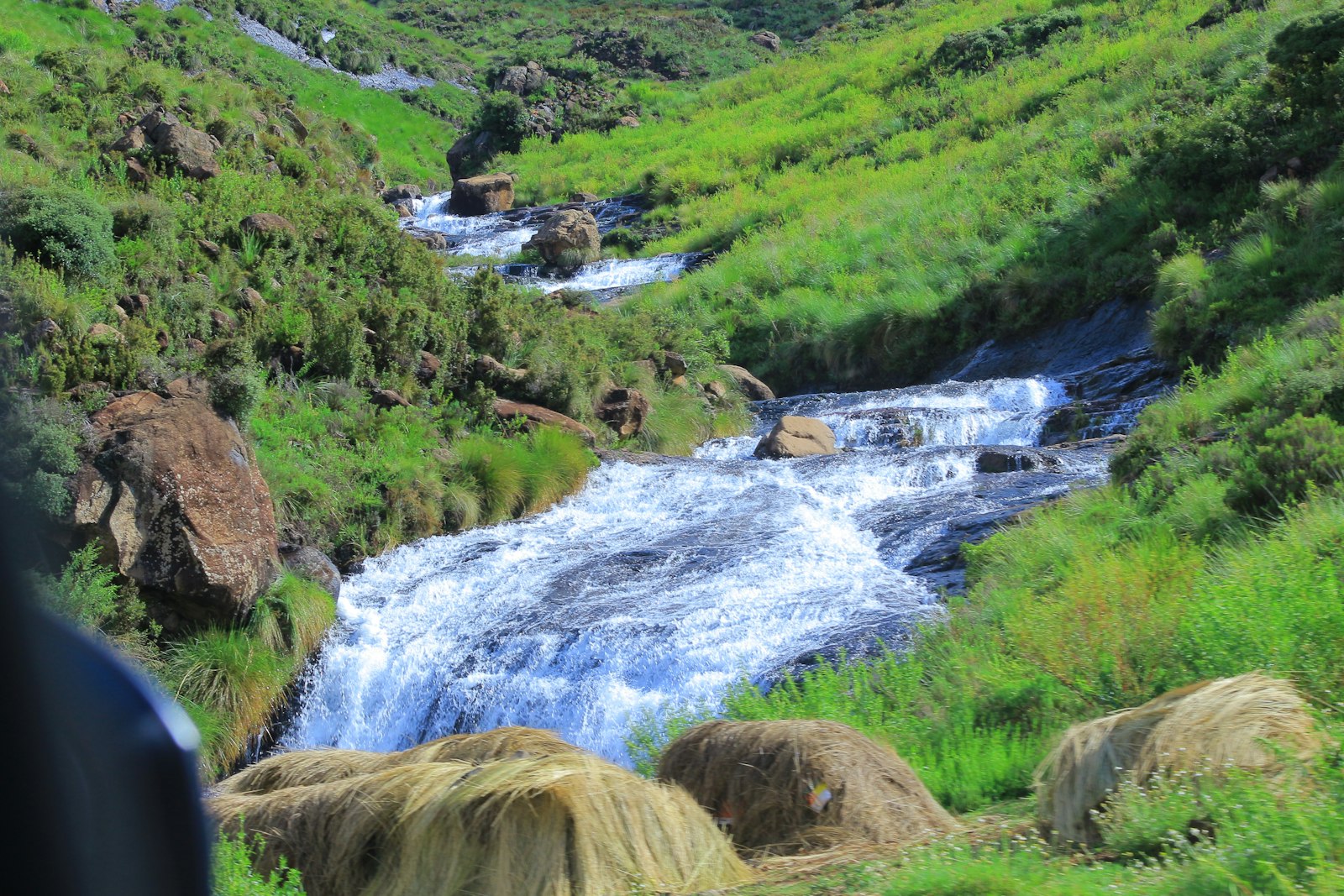
Lesotho is a landlocked country in Southern Africa, completely surrounded by South Africa. Wikipedia calls it the largest of three sovereign enclaves, alongside Vatican City and San Marino. It covers 30,355 square kilometres, and its capital and largest city is Maseru. Sesotho and English are official languages, and the currency, the loti, is at par with the South African rand and can be used interchangeably with it.
Its defining feature is altitude. Lesotho is the only independent state lying entirely above 1,000 metres. The lowest point is 1,400 metres, and over 80 percent of the country is above 1,800 metres. It also contains Thabana Ntlenyana, which Wikipedia calls the highest peak in southern Africa.
Our 18-second Short about Lesotho is below. For the quick version, see our Lesotho travel guide.
Basutoland became independent from the United Kingdom as the Kingdom of Lesotho on 4 October 1966. Population figures differ between sources, from about 2.1 million to about 2.3 million, which shows how rough national figures can be.
The centrepiece of national dress is the Basotho blanket, originally wool though most are now acrylic. The Basotho pony, historically ridden into battle, is now used for transport and agriculture. Wikipedia mentions the annual Morija Arts and Cultural Festival and remnants of 18th to 20th century British trading posts in several villages.
Culturally and logistically, Lesotho is easy to combine with a South Africa trip, but it rewards time on its own, especially in the highlands.
Wikivoyage says Lesotho has about 300 days of sunshine a year. The rainy season runs from October to April, often in severe thunderstorms. Winter nights go below freezing from May to September. Wikipedia notes snow is more common in the highlands from May to September, and higher peaks may see snow year-round. Maseru’s lowlands can reach 30 °C in summer.
Because of the altitude, expect cold nights even in warm months, and strong sun in thin air. Altitude sickness is possible when you arrive, skin burns quickly, and you should drink plenty of water. There is skiing at Afriski and Oxbow in winter, according to Wikivoyage.
If you want pony trekking and hiking, spring and autumn are comfortable choices, though conditions vary. If you want snow, winter is the time, but roads may be affected.
Wikivoyage highlights several experiences:
For many travellers the highlight is simply the landscape: high plateaus, deep valleys and villages reached by foot or pony.
Wikivoyage says your passport should be valid for six months and have at least two blank pages, and a return or onward ticket may be asked for. Stay lengths differ by country: Wikivoyage lists Canada among countries allowed 14 days without a visa and the US among those allowed 90 days. Rules change, so confirm them on the official government page for your passport.
Most visitors arrive by road from South Africa, since Lesotho is entirely surrounded by it. Check border opening hours and vehicle requirements before you travel, and carry all documents with you.
Minibus taxis are the transport of most people. Fares are fixed by the government, but check the price before getting in. Regular taxis have a yellow stripe, and you should always agree the cost first.
Roads in the highlands can be steep and slow, especially in wet or snowy conditions. If you drive, plan routes in daylight and carry spare supplies. Many travellers prefer to join a tour or hire a driver for mountain sections.
Wikivoyage says it is risky to walk alone in Maseru at night, though the main roads are fine by day. Water should be treated before drinking. Hospitals are not of a high standard, and good hospitals exist across the border in South Africa. Wikivoyage reports a very high HIV rate, so ask a travel clinic about precautions. Ask a clinic for current advice before you go.
Wikipedia’s tourism page reports roughly 1.14 million arrivals in 2017, with South Africans making up close to 90 percent of visitors. Zimbabwe, the Netherlands and Germany followed, each far behind. Tourism contributed about 5.5 percent of GDP in 2013 and around 25,000 jobs.
The same source lists Moshoeshoe I International Airport and land border crossings at Maseru and Maputsoe as arrival routes. Most visitors are short-trip or regional travellers, so long-distance visitors often find the mountains quiet outside holiday periods.
The most popular leisure activities listed are hiking, pony trekking, skiing and four-wheel-drive trails, and Afriski operates during the winter months.
These are our own suggestions based on the facts above, not official advice.
Lesotho is easy to underestimate. The distances look small on a map, but the mountains make them feel long, so give each stop more time than you think you need.
The people of Lesotho are the Basotho, and the country’s modern history begins with Basutoland, which became independent from the United Kingdom on 4 October 1966. Wikipedia notes that Sesotho and English are the official languages, and the Basotho blanket is the centrepiece of national dress. The Basotho pony, once ridden into battle, is now a working animal and a main attraction for trekkers.
Several villages still hold remnants of British trading posts from the 18th to 20th centuries, and the Morija Arts and Cultural Festival is held annually in Morija. If your dates allow, a festival visit is a good way to meet people and learn the history.
Because Lesotho is an enclave, it shares economic and cultural ties with South Africa. The loti’s parity with the rand is one visible sign of that. Border crossings, trade and migration are all part of daily life.
Wikipedia describes Lesotho as the largest of three sovereign enclaves, alongside Vatican City and San Marino. It is also the only independent state with every metre of land above 1,000 metres. Together those facts explain much of what visitors experience: cold nights, thin air, steep roads, and a landscape that looks unlike most of Southern Africa.
That altitude shapes everything from the way people build and farm to the way you plan your day. Start walks early, carry layers, and treat the weather seriously. A bright morning can turn into a thunderstorm in the afternoon during the rainy season.
This is our own suggestion, not an official itinerary.
Yes. It is a landlocked enclave entirely surrounded by South Africa.
It is the only independent state entirely above 1,000 metres. The lowest point is 1,400 metres, and over 80 percent of the country is above 1,800 metres.
The loti, which is at par with the South African rand and can be used interchangeably with it.
Yes. Snow is more common in the highlands from May to September, and the higher peaks may see snow year-round.
October to April, often with severe thunderstorms.
A waterfall with a single drop of about 200 metres. You can swim below in summer, and it freezes in winter.
It depends on nationality. Wikivoyage lists some countries as allowed stays of 14 or 90 days without a visa. Check the official rules for your passport.
Minibus taxis with government-fixed fares are the main transport. Yellow-striped taxis exist, and you should agree the price first.
Most visitors begin in Maseru and then head to the mountains. Compare prices and reviews, and check the cancellation terms before you reserve.
See stays in Maseru on Booking.com →
Some links on this page are affiliate links. If you book through them, Letsa Atlas may earn a small commission at no extra cost to you.
We checked this guide on November 8, 2026. Entry rules, road conditions and prices change, and parts of our sources are older. Check your government’s travel advice and official entry rules before you go. Confirm details with official sources before you go.
Sources checked November 8, 2026: Wikipedia: Lesotho · Wikivoyage: Lesotho