A practical guide to Lake Baikal in Siberia: how deep and old it really is, when the ice is walkable, what Olkhon Island and Listvyanka offer, summer on the water, how to get there and what to check about travel to Russia first.
Lake Baikal is in Russia, and travel there is not simple for many visitors. The Moscow Times reports that most Western governments advise against travel to Russia, and the U.S. State Department cites the risk of harassment or wrongful detention by Russian security officials. Some other governments issue no comparable warning, and a few advise increased caution. Check the advice from your own government before you consider a trip.
Practical limits matter too. The same report says Visa and Mastercard cards issued abroad have not worked in Russia since spring 2022, that Airbnb and Booking.com are unavailable, and that the usual route in is a connecting flight through places such as Turkey or the UAE. Entry rules depend on your passport. This guide explains the lake and how visits work, and it is not an encouragement to go.
Lake Baikal is a rift lake in southern Siberia, between Irkutsk Oblast and the Republic of Buryatia. It is about 636 kilometers long, up to 79 kilometers wide, and covers about 31,722 square kilometers. The maximum depth is 1,642 meters (Wikivoyage gives a slightly different 1,637), and the average depth is about 744 meters, so it is the deepest lake on Earth.
Depth also makes it the largest freshwater lake by volume. Wikipedia gives roughly 23,600 cubic kilometers of water, or 22 to 23 percent of the world’s fresh surface water, which is more than all of the North American Great Lakes combined. Its age is estimated at 25 to 30 million years, and UNESCO named it a World Heritage Site in 1996.
Our 41-second Short about Baikal is below. For the quick version, see our Lake Baikal travel guide.
Baikal sits in a rift valley where the Earth’s crust is slowly pulling apart. Wikipedia says the rift widens about 2 centimeters a year and that the fault zone is seismically active, with hot springs in the area. The lake floor lies far below the surface, and Wikipedia calls it the deepest continental rift on Earth.
The water is cold and low in minerals. Wikipedia describes Baikal as one of the clearest lakes in the world. In winter the water transparency in open sections can reach 30 to 40 meters, and in summer it is typically 5 to 8 meters. The lake is also rich in oxygen even in its deep sections, which sets it apart from stratified bodies of water such as the Black Sea.
The lake is fed by as many as 330 inflowing rivers, including the Selenga, the Barguzin and the Upper Angara, and it drains through a single outlet, the Angara. That one outflow is why the water stays in the basin for so long: Wikipedia gives a residence time of about 330 years.
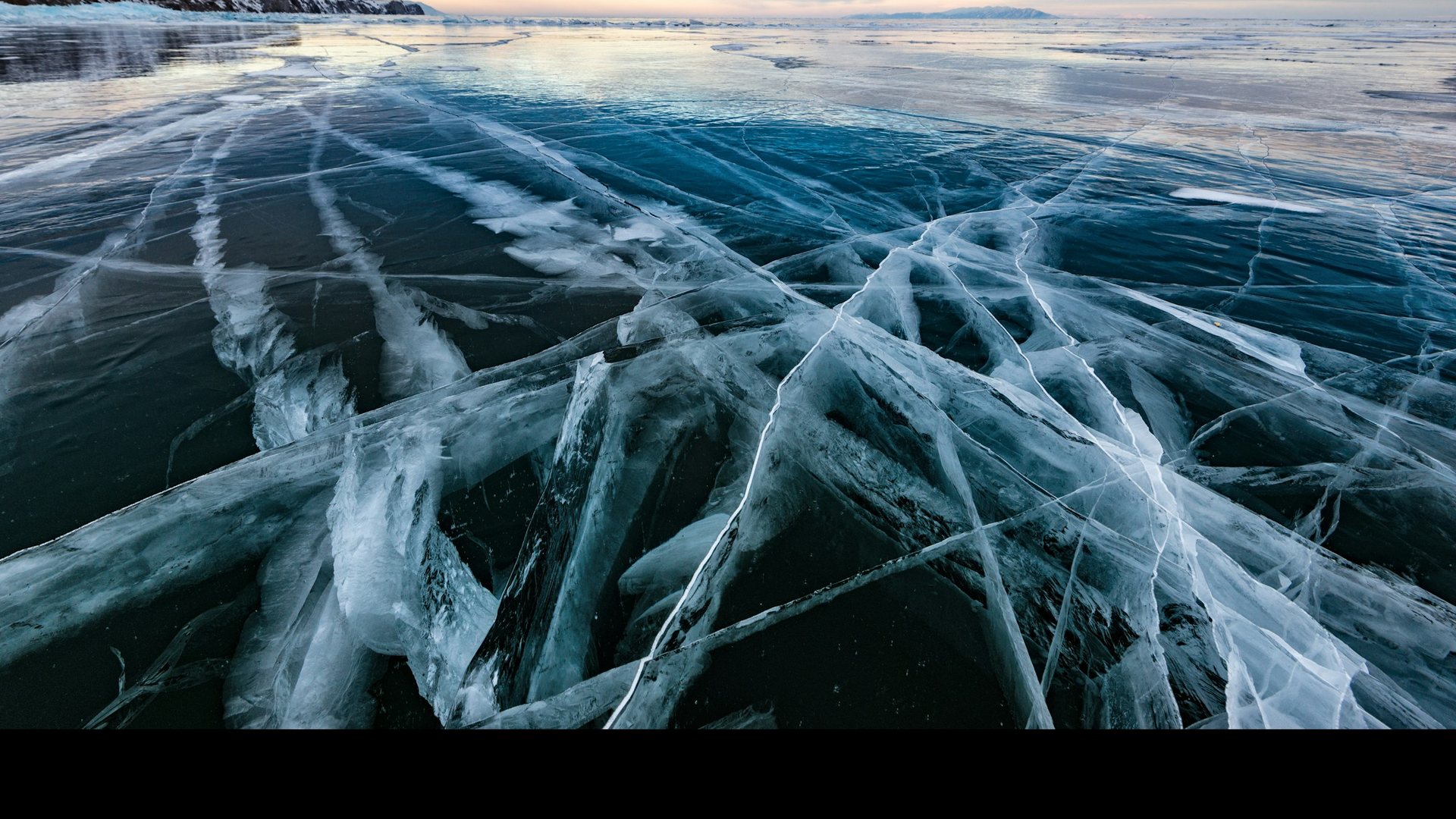
The surface freezes for about four to five months. Wikipedia says the ice cover runs from early January to early May or June, latest in the north. On average the ice is between 0.5 and 1.4 meters thick, and in places with hummocks it can exceed 2 meters. Some tour sites quote thicker ice, so treat any single number as approximate and ask a local guide about current conditions.
| Period | What the lake is like | Good for |
|---|---|---|
| Late November to December | Snow arrives on the land, and the lake may still be freezing | Snow activities on land, such as skiing and dog sledding, according to one winter guide |
| January to early February | The lake usually freezes in late January to early February, though it can start earlier or finish later | Early ice, with conditions that change day to day |
| Late February to March | The most popular window for walking on the ice, with sunny days and large day-to-night swings | Ice walks, skating, hovercraft and car trips with local guides |
| April | The ice weakens and the island of Olkhon can be cut off while it melts | Usually not recommended for ice travel |
Wikipedia notes that vehicles can drive on the ice in the ice season, except heavy vehicles such as tourist buses. The only legal ice road is the 12-kilometer route to Olkhon Island, where the ice is about 60 centimeters thick and the maximum load is 10 tonnes. In 2015 it was open from 17 February to 23 March, so use that as an example of how short the window can be, not as a schedule.
Skating, ice-walking, hiking and cycling on the ice are all popular. One winter guide describes the world’s only international ice marathon, a 42-kilometer race held at the beginning of March. Average winter temperatures are around -20 °C, so plan clothing carefully.
Olkhon is the largest island in the lake, about 72 kilometers long, and Wikipedia calls it the third-largest lake-bound island in the world. Wikivoyage describes the main village, Khuzhir, as having about 1,500 residents, and says the Khuzhir Museum is a cheap and easy first stop. The Shamanka Rock, a small cliff island at the village shore, is a popular sunset spot.
Other places mentioned for day trips include Cape Choboi on the north-east coast, with dramatic cliffs reachable by 4WD, a salty lake called Sahara about 15 kilometers south of Khuzhir, and the Taschkiney valley and Shara-Nuur lake. Wikivoyage notes that many private homes on the island have no running water or showers, so ask your guesthouse about a banya, a Russian steam sauna.
Access changes with the season:
Listvyanka is the closest lake town to Irkutsk, about 75 kilometers away, and the most popular base according to Wikivoyage. Buses leave from Irkutsk through the day, and the ride takes about an hour and a half. Everything in town is within walking distance, and a small waterfront has hotels, shops and boats for short trips.
From Listvyanka you can go by boat to Bolshiye Koty in Pribaikalsky National Park. In summer a hydrofoil runs, and in winter there is an ice road. The shorter Listvyanka to Bolshiye Koty section of the Great Baikal Trail is about 20 kilometers and can be walked in a day. The longer western-shore route from Listvyanka to Bolshoye Goloustnoye is roughly 55 kilometers, usually walked over three days with camping, and much of it lies in a national park that requires a permit arranged in advance. There is no mobile signal on most of the route.
The Circum-Baikal Railway, opened on 13 October 1905, runs along the southern shore. Wikipedia says building it required 200 bridges and 33 tunnels, which makes the slow scenic train from Slyudyanka to Port Baikal a famous ride.
Summer is the other main season. Wikipedia says the surface water reaches up to about 16 °C in the main sections and 20 to 24 °C in shallow southern bays, and that the water stays below 10 °C most of the year. Swimming is possible in a few gulfs, such as Chivyrkuy. Wikivoyage notes that many people consider July the best month for a visit, when temperatures and winds are most favourable.
Summer activities listed by Wikipedia include hiking, small-vessel tours for bird-watching and seal-watching, and fishing. The 100-kilometer Frolikha Adventure Coastline Track in the north is a longer hiking route.
Lake Baikal is home to thousands of species of plants and animals, many of them endemic. The best known is the Baikal seal, called the nerpa, which is found only in this lake. Boat tours aim to see seals resting on rocks, and Wikivoyage mentions seals may be seen near Cape Choboi on Olkhon. Sightings are never guaranteed.
The famous smoked omul fish is also tied to the lake. Wikivoyage notes that in 2018 catching omul during spawning was forbidden because the population had declined, so check what is available. The lake faces environmental pressure as well: Wikipedia describes a pulp and paper mill built on the shore in 1966 and later closed, and notes concerns such as declining omul and algae growth.
The nearest airport is in Irkutsk. One winter guide gives about 5.5 hours of flying from Moscow and about 6 hours from Saint Petersburg, and the train from Moscow takes about 80 hours. Wikivoyage also lists domestic flights from cities such as Novosibirsk, Krasnoyarsk, Vladivostok and Yakutsk. Irkutsk is the usual starting point, and Ulan-Ude is the starting point for the eastern shore.
The Trans-Siberian Railway runs along the southwest edge of the lake for several hours, and Wikivoyage recommends riding it in daylight on your first trip. Long-distance trains stop at Slyudyanka, and the Baikal-Amur Mainline follows the shore from Severobaikalsk northward. Within the lake area, buses, boats and in winter ice roads are the usual links, and a local guide or driver is useful for Olkhon and the north.
Entry requirements depend on your passport, and rules change often. The Moscow Times says many EU citizens can get a short-term electronic tourist visa and some nationalities need no visa, so check with the Russian embassy or consulate for your country. Border officers may question travellers about the purpose of the trip, lodging and work, and may ask to see your phone, so carry nothing you would not want inspected.
The same source says Visa and Mastercard cards issued abroad have not worked since spring 2022, that Chinese UnionPay cards are still accepted and that cash is the simplest option for short stays. Ostrovok.ru and Sutochno.ru are widely used for lodging, and hotels register foreign guests for you. Many websites are blocked and major VPN providers do not work well, so set up any tools before you arrive. A foreign mobile contract is hard to get, so an international eSIM or roaming is the usual option, though availability can change.
Wikivoyage warns that sudden weather changes, especially cold storms, can be dangerous, that not all parts of the lake have strong ice in winter, and that many areas lack easy access to emergency help. These are the main rules we would follow:
This is our own suggestion, not an official itinerary. One winter guide also suggests at least five days to see the main sights.
In summer, swap the ice day for a boat trip and a hike on the Great Baikal Trail, and keep a spare day for ferry or weather changes.
About 1,642 meters at its deepest point, according to Wikipedia, which makes it the deepest lake on Earth. Wikivoyage gives 1,637 meters, so sources differ slightly.
Its age is estimated at 25 to 30 million years, which makes it the oldest lake in geological history.
Wikipedia gives 22 to 23 percent of the world’s fresh surface water, which is roughly a fifth. It is the largest freshwater lake by volume.
The ice cover runs from early January to early May or June, latest in the north. Walkable ice is usually a late-winter experience, especially late February and March.
On average between 0.5 and 1.4 meters, and more than 2 meters in places with hummocks. Always ask a local guide about current conditions.
In winter the water transparency in open sections can reach 30 to 40 meters, which is why clear patches of ice look like glass. Snow and cracks reduce clarity in many places.
Fly to Irkutsk, the nearest airport, then take a bus to Listvyanka or a longer road trip to Olkhon Island. The Trans-Siberian Railway also runs along the southwest shore.
There are two main seasons: ice from mid-January to mid-April, and summer. Many guides point to late February and March for ice walking and July for summer.
Most Western governments advise against travel to Russia, and conditions on the ice can be dangerous. Read your own government’s advice, use local guides and buy insurance that covers the destination.
The Moscow Times reports that Visa and Mastercard cards issued abroad have not worked since spring 2022, so cash is the simplest option for short stays. Check current information before you go.
The Baikal seal, found only in Lake Baikal. Boat tours try to see seals on rocks, but sightings are never guaranteed.
Listvyanka and Olkhon Island are the two usual bases. Booking.com and Airbnb do not offer stays inside Russia, so we do not link a booking site here. Wikivoyage names Ostrovok.ru and Sutochno.ru as widely used lodging sites, and many guesthouses also take direct bookings. Hotels register foreign guests for you. Check the cancellation terms before you pay, and check your own government’s travel advice first.
We checked this guide on November 8, 2026. Ice conditions, ferry and road access, entry rules and prices change, and many governments advise against or restrict travel to Russia. Check your own government’s advice and confirm every step with official or local sources. Confirm details with official sources before you go.
Sources checked November 8, 2026: Wikipedia: Lake Baikal · Wikivoyage: Lake Baikal · Wikivoyage: Olkhon · UNESCO World Heritage: Lake Baikal · The Moscow Times: Travelling to Russia