A practical guide to the driest desert outside the poles: why it is so dry, the Mars connection, El Tatio, Valle de la Luna, Laguna Cejar, flamingos and stargazing, getting to San Pedro de Atacama, altitude and safety, and a 4-day plan.
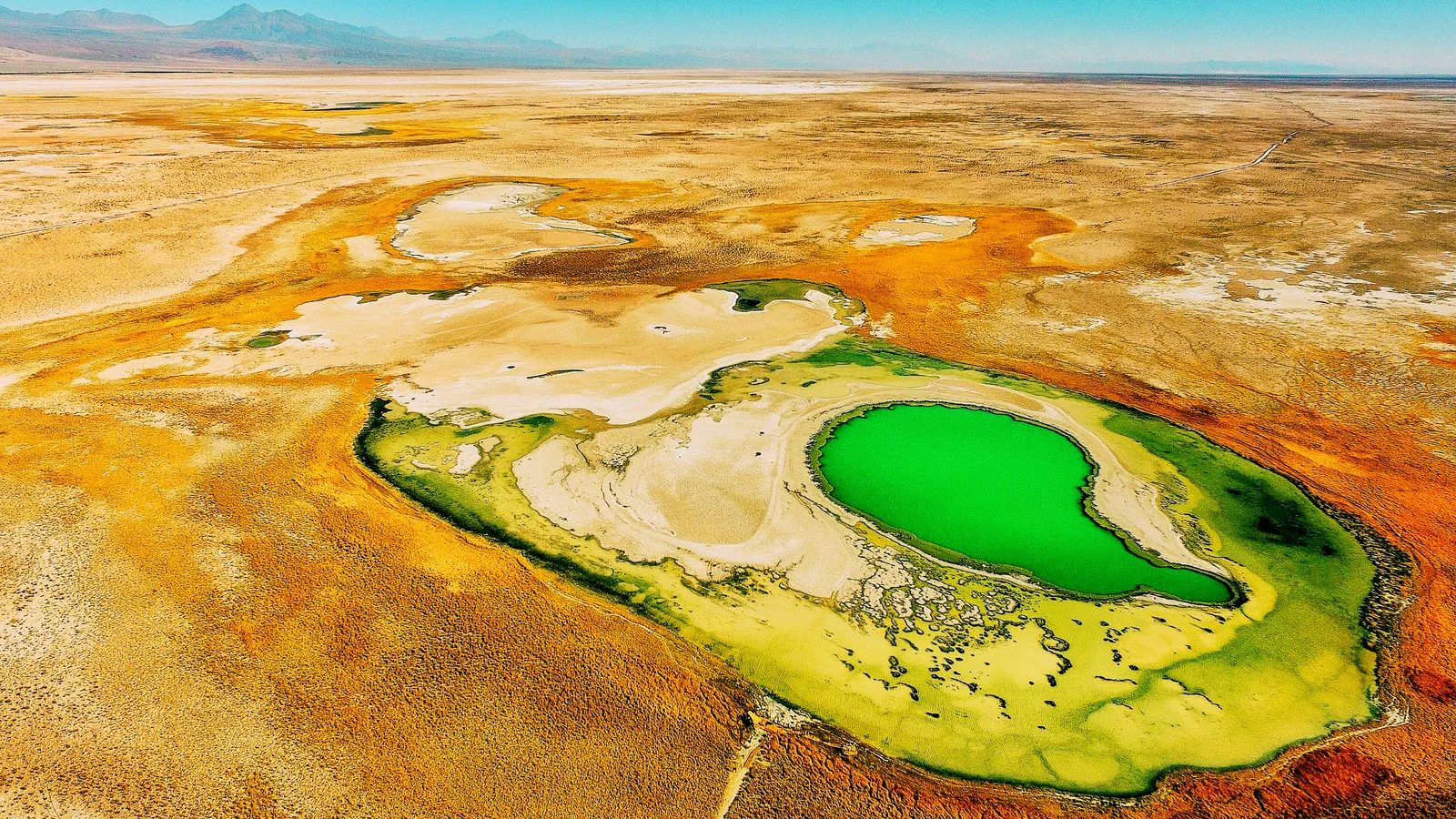
The Atacama Desert is a strip of land about 1,600 kilometers long between the Pacific Ocean and the Andes in northern Chile. Wikipedia gives its area as about 105,000 square kilometers, or about 128,000 if the barren lower slopes of the Andes are included, and calls it the driest non-polar desert in the world. Some of its weather stations have never received rain.
For travellers, the Atacama mostly means San Pedro de Atacama, an oasis town at about 2,400 meters that is the base for almost every tour. From there you can watch geysers steam at sunrise at El Tatio, walk through the salt formations of Valle de la Luna, float in the salty water of Laguna Cejar, see flamingos in the Atacama salt flat and spend a night under some of the clearest skies on Earth.
Our short Atacama video is below. For the quick version, see our Atacama Desert travel guide.
The Atacama sits in a double rain shadow. Wikipedia explains that the desert lies between the Andes and the Chilean Coast Range, which are high enough to block moisture from both the Atlantic and the Pacific side, creating a two-sided rain shadow. A constant temperature inversion caused by the cold Humboldt Current and the strong Pacific anticyclone adds to the dryness.
The result is extreme. Wikipedia says the average rainfall is about 15 millimeters a year, that periods of up to four years without any rain have been registered in the central sector between Antofagasta, Calama and Copiapó, and that evidence suggests the Atacama may not have had any significant rainfall from 1570 to 1971. It is also the only true desert to receive less precipitation than polar deserts.
Moisture still arrives in another form. The Atacama is the largest fog desert in the world, and Wikipedia describes areas called lomas, where fog from the ocean provides enough moisture for seasonal plants and a few animal species. The heat is not the defining feature: the almost total lack of rain is.
Some of the driest parts of the Atacama are among the most Mars-like places on Earth. Wikipedia describes the region around Yungay, south of Antofagasta, where scientists repeated the tests used by NASA’s Viking 1 and Viking 2 Mars landers to look for life and could not detect any signs of it in the soil. In 2014 an even drier site, María Elena South, was reported.
Because of this, Wikipedia says, the region is used by NASA to test instruments for future Mars missions, and it has been used for Mars expedition simulations. Its otherworldly scenery has also been used to film Mars scenes for television. Perchlorates, the salts the Phoenix Mars Lander found on Mars in 2008, also occur in the Atacama.
Rare heavy rain changes everything. Wikipedia records unusual rainfall in June 1991 around Antofagasta that caused deadly mudflows, and heavy rain in the southern Atacama in March 2015, after which the desert bloomed pink later that year. In Chile this phenomenon is known as the desierto florido, the flowering desert.
The bloom happens mainly in the southern Atacama and only in some years, after enough rain has fallen, so it cannot be planned like a regular season. If it is happening during your trip, local news and tourism offices will usually report where the flowers are.
El Tatio is a geothermal field high in the Andes at about 4,320 meters above sea level. Wikipedia calls it the third-largest geyser field in the world and the largest in the Southern Hemisphere, and Wikivoyage says it has more than 80 active geysers. It lies about 100 kilometers from San Pedro de Atacama, and an old Inca trail once crossed the field.
The geysers are best at dawn, when the cold air makes the steam columns tall and dense. Wikivoyage says most agencies leave town at about 04:00 and recommends choosing one that promises sunrise in the geyser valley, because some leave for the hot springs before the sun reaches the ground. The thermal pool nearby is not very hot, and the air is often below freezing. On the way back, tours often stop to see wild vicuñas and birds at the Putana river.
Valle de la Luna, the Moon Valley, is part of the Cordillera de la Sal, the salt mountain range just west of San Pedro. Wikivoyage describes folded rock formations in a perfectly barren landscape, stone walls that resemble the Grand Canyon without the river, and halite strata that make a knocking sound in the heat. Its sights include the Great Crater, the Salt Canyon, the Three Marias, salt caves and the Cari viewpoint.
Almost every tour visits at sunset, when the colours of the valley and the volcanoes behind it change from orange to pink. Wikivoyage says the ticket must be bought online, because none are sold at the entrance, and that the fee is not included in tours. The valley is close enough to town to visit by bicycle, which many travellers enjoy, as long as they carry plenty of water and avoid the midday heat.
The big dune near the valley is the usual place for sandboarding. Wikivoyage says it is almost 100 meters high, though the track used for boarding is shorter, and that boards can be rented in town.
Laguna Cejar lies at the northern tip of the Salar de Atacama, the large salt flat south of San Pedro. Wikivoyage says its water is as salty as the Dead Sea, so you can float without effort even if you cannot swim, with a wide view of the Andes. It is one of the most popular trips from town.
Tours usually leave in the afternoon. Wikivoyage says they often add the Ojos del Salar, two freshwater pools close together, and end at Laguna Tebenquinche, a still lagoon where the sunset colours of the mountains are reflected on the water. It listed an entrance fee of 15,000 pesos for Laguna Cejar in 2022, and some agencies offer the cheaper Laguna Escondida as an alternative. Bring a towel and fresh water to rinse off the salt, and protect your eyes.
Flamingos are one of the surprises of the driest desert on Earth. Wikivoyage says three species of flamingos inhabit Laguna Chaxa year-round. It is part of the Los Flamencos National Reserve in the heart of the Atacama salt flat, and the classic half-day or full-day trip, often sold as the Altiplanic Lagoons, combines it with the village of Toconao and its bell tower.
The same trip usually climbs to Laguna Miscanti and Laguna Miñiques, two deep blue lagoons at about 4,200 meters below snow-capped volcanoes, with a lunch stop in the hamlet of Socaire. Some tours continue to Piedras Rojas, a lagoon edged with red rocks. Because of the altitude, this is a good trip for the middle of your stay.
The same dry, clear, high air that keeps the desert barren makes it one of the best places in the world to look at the sky. Several of the major astronomical observatories of the Atacama are in the wider San Pedro area, according to Wikivoyage, and local agencies run stargazing tours with telescopes away from the lights of town. Nights without a bright moon are best.
The most famous observatory is ALMA, the Atacama Large Millimeter/submillimeter Array. Wikipedia says its antennas stand on the Chajnantor plateau at about 5,000 meters, and Wikivoyage calls it home to the most advanced radio telescopes in the world. The high site is not open for casual visits, so check the observatory’s official website for any public visit programme before you plan around it.
You can visit the Atacama all year. Days are usually sunny and dry, while nights are cold, and at the geysers and high lagoons temperatures often drop below freezing. Summer, from December to March, is the busiest season around Christmas and the Chilean holidays, and occasional storms in the high Andes can affect mountain roads. Winter days are pleasant, but nights at altitude are very cold.
Whatever the season, the sun is intense at this altitude. Bring sunglasses, a hat, sunscreen and lip balm, and drink more water than you think you need.
No airlines fly directly to San Pedro de Atacama. Wikivoyage says the nearest commercial airport is Calama, with mostly direct flights from Santiago and a few to Antofagasta and Iquique, operated by several Chilean airlines. From Calama, regional buses take about 1.5 to 2 hours to San Pedro, and minivan companies run shared transfers from the airport to hotels.
By bus, Wikivoyage lists services from Calama several times a day, and longer routes from Antofagasta, Iquique, Arica and Santiago, plus international buses from Salta and San Salvador de Jujuy in Argentina. It recommends changing in Calama, where national buses are frequent. San Pedro is also the usual starting point for multi-day tours across the border to the Salar de Uyuni.
San Pedro itself is small and walkable. Wikivoyage describes a centre of about twelve blocks with a pedestrian main street, Caracoles, and says bicycles can be rented for nearby sights such as Valle de la Luna and the ruins of Pukará de Quitor. Cycling in the town centre itself is not allowed.
For El Tatio, the high lagoons and stargazing, most visitors book tours with the many agencies in town or online. Wikivoyage notes that a rental car can be the cheapest and most flexible option for a group, but warns about altitude, fuel, flat tyres on dirt roads and the cold at night. Ask agencies exactly what is included, especially entrance fees, meals and pick-up times, and compare reviews rather than price alone.
Wikivoyage reminds visitors that San Pedro is at about 2,400 meters and that some attractions are well above 4,000 meters. It advises people with heart or lung problems to consult a doctor before booking, lists dizziness, nausea, headaches and shortness of breath as typical symptoms of altitude sickness, and says the only real cure is going lower.
Plan the easier, lower trips such as Valle de la Luna and Laguna Cejar for your first days and the geysers and high lagoons later. Drink plenty of water, avoid heavy drinking on arrival and bring warm clothing for the early mornings.
Wikivoyage says there is virtually no violent crime in San Pedro, but that bicycles and cars are sometimes stolen, the streets are poorly lit at night and the town has many stray dogs, most of them friendly. Use normal precautions with your belongings.
San Pedro de Atacama has accommodation for every budget, from simple hostels and guesthouses to boutique hotels and all-inclusive desert lodges. Wikivoyage notes that it is one of Chile’s three most popular destinations and a fairly expensive place, and recommends comparing offers on booking websites. Three or four nights are a good minimum, because they let you adjust to the altitude between trips. Book ahead around Christmas and the Chilean summer holidays.
Entry rules depend on your passport, so check the official Chilean requirements for your nationality, including visa rules, passport validity and any health requirements. The currency is the Chilean peso. If you arrive or leave on a tour across the border with Bolivia or Argentina, ask your operator how the border formalities work.
This is our own suggestion, not an official itinerary. It keeps the highest trips for later in the stay.
It is the driest non-polar desert. Wikipedia describes it as the driest non-polar desert in the world and the second driest overall, behind some spots in Antarctica’s McMurdo Dry Valleys. It says some weather stations in the Atacama have never received rain and that the average is about 15 millimeters a year.
Not everywhere. Wikipedia says evidence suggests that the Atacama may not have had any significant rainfall from 1570 to 1971. Rare storms do happen, and after heavy rain parts of the southern Atacama can burst into flower.
Because some of its soils are among the most Mars-like on Earth. Wikipedia says the area around Yungay was so dry that tests copied from the Viking Mars landers could not detect signs of life there, and that NASA uses the region to test instruments for future Mars missions.
Most visitors stay in San Pedro de Atacama, a small oasis town at about 2,400 meters. Almost every tour starts there, and the town has hostels, hotels and desert lodges.
Fly to Calama, mostly from Santiago, then take a bus of about 1.5 to 2 hours or a shared minivan transfer. Wikivoyage also lists long-distance buses from Antofagasta, Iquique, Arica and Santiago, and from Salta and Jujuy in Argentina.
Very early. Wikivoyage says most agencies leave San Pedro at about 04:00 so that you reach the geysers before sunrise, when the steam columns are tallest. The field is about 100 kilometers from town and above 4,000 meters, and temperatures are usually below freezing at dawn.
Yes. Wikivoyage describes Laguna Cejar as a lagoon with water as salty as the Dead Sea, so you float even if you cannot swim. It lists an entrance fee for the site and says tours usually leave in the afternoon and end with sunset at nearby lagoons.
Yes. Wikivoyage says the ticket must be bought online because none are sold at the entrance, and that the entrance fee is not included in tours. Check the current price and opening hours before you go.
ALMA’s antennas stand on the Chajnantor plateau at about 5,000 meters, which is not open for casual visits. Check the observatory’s official website for any public visit programme and booking rules before you plan around it.
San Pedro is at about 2,400 meters, and El Tatio and the high lagoons are above 4,000 meters. Wikivoyage advises people with heart or lung problems to consult a doctor before booking and says the only real cure for altitude sickness is going lower. Spend a day or two in San Pedro before the highest trips.
Compare El Tatio sunrise trips, Valle de la Luna sunset tours, Laguna Cejar floating trips, flamingo lagoons, stargazing and sandboarding from San Pedro de Atacama, with reviews and free-cancellation options.
Find Atacama tours on Viator →Compare on GetYourGuide →
Travel insurance. Medical care abroad can be expensive, and high altitude, early-morning drives and remote desert roads add risk on a trip like this, so many travellers buy cover before they leave. One option is SafetyWing Nomad Insurance. Read the policy wording to see what it covers, including altitude and organised tours, before you buy.
San Pedro de Atacama is the base for every tour, from hostels to desert lodges. Stay three or four nights so you can adjust to the altitude, and book ahead in the summer holidays. Compare prices and reviews, and check the cancellation terms before you reserve.
See stays in San Pedro de Atacama on Booking.com →Compare on Expedia →
Some links on this page are affiliate links. If you book through them, Letsa Atlas may earn a small commission at no extra cost to you.
We checked this guide on November 17, 2026. Prices, fees, hours, timetables and entry rules change. Confirm them with tour operators, park offices, airlines and bus companies, the Chilean authorities and your own government before you travel.
Sources checked November 17, 2026: Wikipedia: Atacama Desert · Wikivoyage: San Pedro de Atacama · Wikipedia: El Tatio · Wikipedia: ALMA