Chile stretches over 4,300 kilometers from north to south, yet is only about 175 kilometers wide on average, up to 350 at its widest and 64 at its narrowest. That makes it roughly 24 times longer than it is wide. The capital and largest city is Santiago, and the population was 18,480,432 at the 2024 census.
For a traveller, the shape is the main planning fact. A trip from the Atacama Desert in the north to Patagonia in the south crosses many climates and a very long distance, so most visitors choose one or two regions rather than the whole country.
For the quick version of this page, see our Chile travel guide.
Chile sits between the Pacific Ocean and the Andes. The country covers 756,102 square kilometers without its Antarctic claim, which is about 1,250,000 square kilometers and suspended under the Antarctic Treaty. The long, narrow shape means that moving a few hours in latitude changes the weather, the vegetation and the way people live.
It has 16 regions, 56 provinces and 348 communes. Independence was declared on 12 February 1818, after a government junta was formed on 18 September 1810, and it was recognised on 25 April 1844.
The Far North covers the first three regions, up to parallel 26°S, and contains the Atacama Desert, described as the most arid in the world. The north is also where the highest volcanoes are: Nevado Ojos del Salado at 6,891 meters, the highest volcano in the world, Parinacota at 6,348 meters and Pomerape at 6,282 meters.
Plan for altitude, sun and dry air. Drink water, protect your skin, and give yourself a day to adjust before doing anything strenuous at height.
Santiago is the country's main city and the usual arrival point. Central Chile has a Mediterranean-type climate and is the heart of the wine industry, and Chile is usually among the ten largest wine producers in the world, sixth in 2018.
From Santiago you can reach the coast, the vineyards and the mountains in a day trip, which is why many first visits begin here.
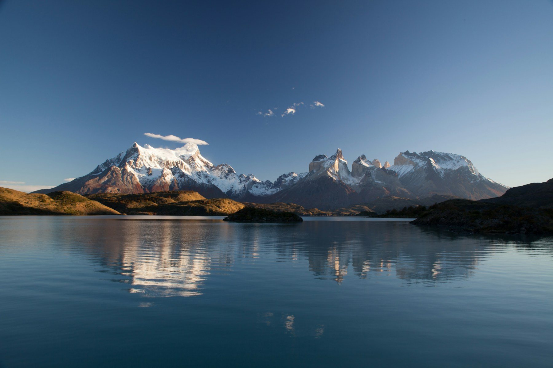
Patagonia extends south from parallel 41°S. Torres del Paine is one of the main attractions, and it is the region most visitors imagine when they think of Chile: glaciers, lakes, wind and long views. Weather changes quickly, so carry layers and waterproofs.
Distances are large, and many places are reached by long road journeys, ferries or flights, so build slack into your plan.
Easter Island was incorporated into Chile in 1888 and has a tropical climate. It is far from the mainland, so it needs its own flight and its own plan, and the Rapa Nui language is one of the languages of Chile.
The country has at least eighteen major Köppen climate subtypes, so there is no single best month. The seasons are the opposite of the northern hemisphere: summer is December to February, autumn March to May, winter June to August and spring September to November.
As a rough guide, summer is the main season in Patagonia, while the north is usable all year and the centre is pleasant in spring and autumn. Check conditions for the specific place and month you plan to visit.
Because the country is so long, internal flights are common between regions, and long-distance buses are widely used. We have not verified current schedules or prices, so check with operators. Allow more time than the map suggests, especially in the south, where weather can delay transport.
Entry rules depend on your passport and can change, so confirm them before booking.
Santiago has the widest choice of places to stay. In popular areas such as Patagonia, book well ahead in the main season. The currency is the Chilean peso, and Spanish is the official language. Indigenous languages include Mapudungun, Aymara, Quechua, Kawésqar and Rapa Nui.
Chile is usually among the ten largest wine producers in the world, and wine is one of the easiest ways to organise a visit to the central valleys. Many estates take visitors, usually by booking ahead, and tastings are often combined with lunch. Seafood is a strength of a country with such a long coast, so it is worth eating fish and shellfish where it is landed.
Ask locally about specialities in each region, since the climate and the coast change what is available from the north to the south.
The Andes run along the whole eastern edge of the country, and the volcanoes are among its defining features. Ojos del Salado, at 6,891 meters, is the highest volcano in the world, and it sits alongside peaks such as Parinacota and Pomerape on the high northern border.
Volcanic and mountain areas can close because of weather or activity. Check current conditions with park authorities, take a guide for high routes if you are not experienced, and do not rely on mobile coverage.
We have not verified current prices, so check before you budget. Chile is a long country, so transport can be a large part of the cost, especially if you add flights between regions. National parks and tours may need advance booking in the main season, and in some places the number of visitors is limited.
Carry some cash in Chilean pesos for small purchases, and keep a copy of your passport and insurance details with you.
Pack for several climates if you will cross regions: sun protection for the desert, layers for Patagonia and a light jacket for the centre. Learn a few phrases of Spanish, since English is less common outside tourist areas. Leave slack in your schedule for weather, and avoid booking tight connections between long-distance buses and flights.
Choose by region and do not try to see everything.
These are our own suggestions, not official itineraries.
Chile is a seismic country. The 27 February 2010 earthquake had a magnitude of 8.8 and killed over 500 people, mostly in the tsunami that followed. Buildings are designed with this in mind, and visitors should learn the evacuation routes where they stay. Follow local advice, and check conditions in the mountains and on volcanic trails before setting out.
About 4,300 kilometers from north to south.
About 175 km on average, up to 350 km at the widest and 64 km at the narrowest.
Roughly: 4,300 km divided by an average width of about 175 km is about 24.
Santiago.
The Chilean peso.
Nevado Ojos del Salado, 6,891 meters, the highest volcano in the world.
Summer is December to February and winter is June to August.
The Atacama Desert, described as the most arid in the world.
Santiago is the usual starting point and has the widest choice. In other regions, book ahead in the main season. Compare prices and reviews, and check the cancellation terms before you reserve.
See stays in Santiago on Booking.com →
Some links on this page are affiliate links. If you book through them, Letsa Atlas may earn a small commission at no extra cost to you.
We checked this guide on November 10, 2026. Entry rules, park rules, prices and transport schedules change, so confirm them with official sources before you go. Confirm details with official sources before you go.
Sources checked November 10, 2026: Wikipedia: Chile · Chile Travel