A practical guide to Bolivia: the Salar de Uyuni, how to handle altitude in La Paz, the Yungas Road, the best time to go, how to get around, and the safety issues to know about.
Bolivia is the fifth-largest country in South America, at about 1.1 million square kilometers, and one of the highest. The west is dominated by the Altiplano, a high plateau, and the elevation across the country ranges from about 90 meters to 6,542 meters at Nevado Sajama. Sucre is the constitutional capital and La Paz the seat of government, at about 3,650 meters above sea level.
About two million tourists visited Bolivia in 2023, around half of them foreign. The most frequently visited sites include the Salar de Uyuni, Nevado Sajama, Torotoro and Madidi national parks, Tiwanaku and La Paz. Spanish is official, along with 36 indigenous languages including Guaraní, Aymara and Quechua, and the currency is the boliviano.
Our 18-second Short about Bolivia is below. For the quick version, see our Bolivia travel guide.
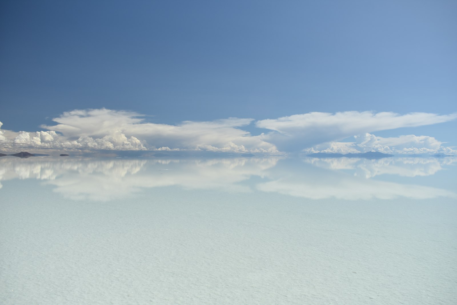
The Salar de Uyuni covers about 10,582 square kilometers at an elevation of about 3,650 meters, and it is the largest salt flat in the world and an important source of lithium. Bolivia has an estimated 23 million tonnes of lithium, about 22 percent of the world’s known reserves, and most of it is in the Salar.
The salt flat looks different depending on the season:
Typical stops include Isla Incahuasi, an island inside the Salar with giant cacti and colonies of viscachas, and the train cemetery about 3 kilometers outside Uyuni, where trains built by British engineers in 1888 to 1892 for carrying minerals were abandoned in the 1940s. The town of Colchani is where the miners’ cooperative is based. Uyuni is the gateway town, and some hotels are built largely from salt blocks. Multiple fatal accidents have been linked to poorly maintained tour vehicles and weak regulation, so compare operators carefully.
Bolivia’s highlights are spread over very different landscapes, and the altitude changes from one to the next.
This variety is why a Bolivia trip needs more planning than most. Distances are long, only about 5 percent of roads are paved, and weather and blockades can change your plans, so it is better to choose two or three regions than to try to see everything.
La Paz sits at about 3,650 meters, Potosí at about 4,010 meters and the Lake Titicaca area at about 3,400 meters. Altitude affects almost everyone at first, so take your first days slowly. Pharmacies sell altitude-sickness pills and coca tea is widely available. UV is much stronger at altitude, so bring high-SPF sunscreen, a hat and sunglasses.
The most important rule is to give yourself time. If you fly directly into La Paz from near sea level, avoid strenuous activity for the first day or two, drink plenty of water and eat lightly. Coca tea is the traditional remedy in the Andes, and pharmacies sell altitude-sickness pills, but anyone with a heart or lung condition should ask a doctor before going.
Lake Titicaca, shared with Peru, is the highest commercially navigable lake in the world and the largest lake in South America. Near it, Tiwanaku, whose settlement dates to as early as 1500 BC, was the capital of a polity that declined around AD 1000.
The Yungas Road, nicknamed the Death Road, is a roughly 64-kilometer descent from La Cumbre, at about 5,000 meters, to Coroico. The Inter-American Development Bank called it the world’s most dangerous road. The northern portion is largely unpaved, has no guardrails and was cut into the mountain in the 1930s. Today many visitors ride it by mountain bike with a tour operator, which is safer than driving it, but choose an operator with good equipment and a safety record.
The east of the country is tropical and humid, and the west is dry with cold winters. In general, November to March is warmer and wetter, and April to October is colder and drier. La Paz is cold in April and May, so pack warm layers.
The choice of season also changes what you see on the Salar de Uyuni: the mirror effect appears in the wet months, while the dry season gives you easier access to the whole flat. If the mirror is your priority, plan for the rainy months and keep extra days, because rain also affects roads and tours.
The main airports are La Paz in the west and Santa Cruz in the east. Overland routes exist from Peru, Brazil and Argentina, but only about 5 percent of roads are paved. Buses are cheap and many run overnight, so compare companies. Domestic flights and the scenic Oruro to Uyuni train are alternatives, and the train is best booked a few days ahead.
Road blockades are common and can last days. Do not try to drive around or through them. Strikes often affect taxis and long-distance buses, so build spare days into your plans.
Watch for the fake plain-clothes police scam, reported mainly in La Paz, Cochabamba and Sucre. Never hand over your passport or valuables or get into a vehicle with strangers. Avoid shared taxis, and use radio taxis at night. Refuse food or drinks from strangers on long bus rides.
Do not drink tap water. Ask a travel clinic about yellow fever and malaria for rural lowland areas. Entry rules depend on your passport, so check official sources.
This is our own suggestion, not an official itinerary.
The mirror effect appears after rain, roughly November to March, with January the wettest. The dry season, roughly April to November, makes access easier. Flamingos breed there in November.
About 3,650 meters above sea level. Take it slowly for the first days, drink water, and ask a pharmacy about altitude-sickness remedies.
The Yungas Road was called the world’s most dangerous road by the Inter-American Development Bank. Today many visitors ride it by mountain bike with a tour operator, and choosing a good operator matters.
Common risks include the fake plain-clothes police scam, unlicensed shared taxis and food or drinks from strangers on long bus rides, plus road blockades and strikes. Use radio taxis at night.
No, do not drink tap water.
Buses are cheap and many run overnight. Domestic flights and the Oruro to Uyuni train are alternatives. Only about 5 percent of roads are paved, and road blockades are common.
The boliviano.
Our suggestion is about 10 days for La Paz, the Yungas Road, Sucre or Potosí and a Salar de Uyuni tour, with a spare day for blockades or delays.
Uyuni is the gateway town for the salt flats. Compare prices and reviews, and check the cancellation terms before you reserve.
See stays in Uyuni on Booking.com →
Some links on this page are affiliate links. If you book through them, Letsa Atlas may earn a small commission at no extra cost to you.
We checked this guide on November 8, 2026. Entry rules, road blockades, tour regulation and prices change at short notice in Bolivia. Check official government advice and local news before you travel. Confirm details with official sources before you go.
Sources checked November 8, 2026: Wikipedia: Bolivia · Wikipedia: Salar de Uyuni · Wikivoyage: Bolivia