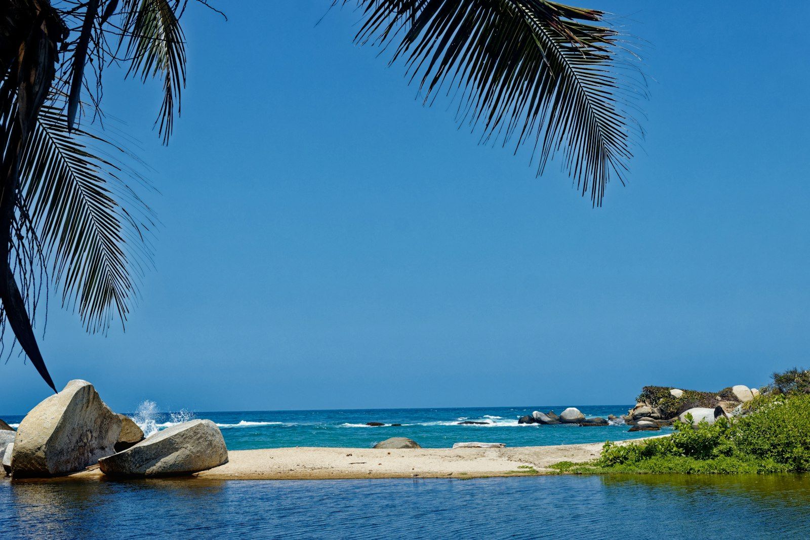
A practical guide to Tayrona National Park in Colombia: the mountains behind the coast, closure dates, entry costs, getting there from Santa Marta, the trail to Cabo San Juan, swimming rules, weather and where to stay.
Tayrona National Natural Park is on Colombia’s northern Caribbean coast, in the department of Magdalena, about 34 kilometres from the city centre of Santa Marta. Wikipedia gives its land area as 150 square kilometres, plus about 30 square kilometres of Caribbean sea, and says it was established on 24 April 1964. It was the second most visited national park in Colombia in 2022, with 545,760 visitors.
Behind the coast rises the Sierra Nevada de Santa Marta, which our Short describes as reaching about 5,700 metres, the highest coastal mountain range on Earth. The park’s biodiversity is tied to that range, and the park’s elevation runs from sea level to 900 metres.
Our 18-second Short about Tayrona is below. For the quick version, see our Tayrona travel guide.
The Sierra Nevada de Santa Marta is about 42 kilometres in a straight line from the Caribbean coast to the permanent snow line. Climb from the sea and you pass dry scrub, rainforest, cloud forest, cold moorland and finally snow, all on one mountain. Four Indigenous peoples, the Kogi, Arhuaco, Wiwa and Kankuamo, call the Sierra Nevada home, and they describe themselves as the guardians of the heart of the world.
That matters for visitors. Parts of the park are sacred, and some areas are closed at the request of Indigenous residents. Wikipedia notes that El Pueblito has been closed to hikers since 2019 for that reason. Do not photograph Indigenous people without their consent.
In 2026 the park closes for three two-week periods: 1 to 15 February, 1 to 15 June, and 19 October to 2 November. The dates follow the Indigenous spiritual calendar and repeat each year, so check them before you book flights and accommodation.
Closures also affect nearby businesses, so a sudden change can ripple through your plans. Confirm the dates with Parques Nacionales Naturales de Colombia.
The driest months are December to March, plus June and July, which bring the best weather and the biggest crowds. April, May and August are quieter and still pleasant. September to November tends to be very rainy.
Wikipedia reports sea-level temperatures of 27 to 35 °C, mean annual relative humidity of 87 percent and about 1,248 millimetres of rainfall over 120 rainy days a year. Expect heat and humidity all year, so carry water and protect yourself from the sun.
The main El Zaino entrance is about 32 kilometres from Santa Marta. Public buses leave from Santa Marta’s Mercado Público about every 15 minutes, and the ride takes 1 to 1.5 hours and costs around 10,000 Colombian pesos. You can also reach Cabo San Juan by boat from Taganga or El Rodadero, weather permitting.
From El Zaino, a shuttle covers about 4.5 kilometres to the trail start, then the walk to Cabo San Juan is about 6 kilometres and mostly flat.
As of 2026, El Zaino and Calabazo are open from 8:00 to 17:00. Arrive before 9:00, because tickets stop once daily capacity is reached. Foreign visitors paid 81,000 pesos in low season and 96,500 pesos in high season, plus mandatory daily medical insurance of about 6,000 pesos. Bring your original passport, cash (there are no ATMs in the park) and a refillable bottle. Single-use plastics are banned.
Prices change, so treat these as the figures we found on 1 November 2026.
Swimming is banned at some beaches, including Arrecifes and Cañaveral. A red flag means no entry to the water. Currents can be strong, so follow signs and ask staff which beaches are safe.
Wikipedia describes protected offshore dive sites, including shallow training areas and areas with currents and depth suited to drift diving, so conditions are varied. If you want to dive, use a licensed operator.
Wikipedia reports about 108 mammal species, including the mantled howler and oncilla, and about 300 bird species such as the military macaw. It also lists about 31 reptile species, 15 amphibian species and 401 sea and river fish species. The park is one of three Colombian Caribbean national parks with coral reefs, and Wikipedia lists around 110 coral species there.
Those numbers are a reminder that the park is a protected ecosystem, not just a beach destination. Stay on trails, keep your distance from animals and take everything you bring back out.
Santa Marta’s historic centre is best for a first visit, with walkable streets, restaurants and the marina, and about 45 minutes by private vehicle to El Zaino. Taganga is a small fishing bay about 5 kilometres north of the centre, suited to budget travellers and divers. El Rodadero is Santa Marta’s busiest beach district. Bello Horizonte and Pozos Colorados are quieter and more upscale.
Entry rules depend on your passport, so check Migración Colombia for yours, including how long you can stay without a visa and how long your passport must be valid. Colombia also requires the free Check-Mig form, filled in online between 72 hours and 1 hour before your flight. Carry a copy of your onward ticket, since officers sometimes ask for one.
These are our own suggestions, not official advice.
Most visitors treat Tayrona as a day trip or an overnight. A day trip is possible, but the walk to Cabo San Juan is about 6 kilometres each way, so you spend much of the day walking. If you want time on the beach, consider one night, and book accommodation early in high season.
The park is popular, and daily capacity is limited. Arrive early, check closure dates, and have a plan for a rainy day if you travel between September and November.
Wikipedia notes archaeological evidence of human settlement in the area up to the 16th century, and an archaeological museum at the Cañaveral site, the Archaeological Museum of Chairama. Named attractions include the Los Naranjos path, Castilletes beach, the pool, the Piedras River and the San Juan outlook. Ask the park staff which trails are open on your date, since closures and rules can change.
Visiting with respect is part of the experience. The Indigenous peoples of the Sierra Nevada regard this landscape as sacred, and the closure periods exist for spiritual reasons, not convenience.
This is our own suggestion, not an official itinerary.
In 2026 it closes for 1 to 15 February, 1 to 15 June, and 19 October to 2 November. The dates follow the Indigenous spiritual calendar and repeat each year.
The main El Zaino entrance is about 32 kilometres from Santa Marta. Buses take 1 to 1.5 hours.
As of 2026, foreign visitors paid 81,000 pesos in low season and 96,500 pesos in high season, plus about 6,000 pesos for mandatory daily medical insurance.
December to March, plus June and July, are the driest months. September to November tends to be very rainy.
Swimming is banned at some beaches, including Arrecifes and Cañaveral. A red flag means no entry to the water.
About 150 square kilometres of land plus about 30 square kilometres of sea, according to Wikipedia.
No. Bring cash and your original passport.
It depends on your passport. Check Migración Colombia for your nationality. Colombia also requires the free Check-Mig form, filled in online between 72 hours and 1 hour before your flight.
The Sierra Nevada is home to the Kogi, Arhuaco, Wiwa and Kankuamo peoples, who regard the area as sacred. Some places are closed to visitors at their request, and photographing Indigenous people without consent is not appropriate.
Most visitors stay in Santa Marta or Taganga. Compare prices and reviews, and check the cancellation terms before you reserve.
See stays in Santa Marta on Booking.com →
Some links on this page are affiliate links. If you book through them, Letsa Atlas may earn a small commission at no extra cost to you.
We checked this guide on November 8, 2026. Prices, hours, closure dates and entry rules change. We checked the practical details on 1 November 2026. Confirm them with Parques Nacionales Naturales de Colombia and Migración Colombia before you travel. Confirm details with official sources before you go.
Sources checked November 8, 2026: Wikipedia: Tayrona National Natural Park · Parques Nacionales Naturales de Colombia · Migración Colombia