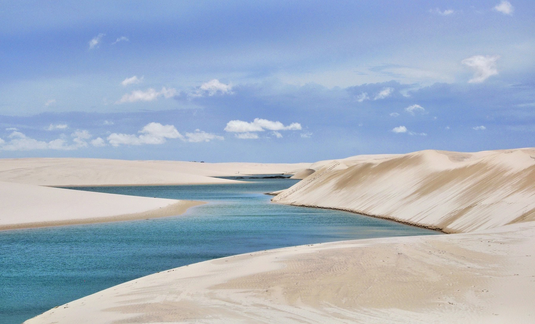
A practical guide to Lençóis Maranhenses in Brazil: why a field of white dunes holds turquoise lagoons, the months when the water is there, how to get from São Luís to Barreirinhas and Atins, how tours work and what to pack.
Lençóis Maranhenses National Park is in the northeastern part of Maranhão state in Brazil, just east of the Baía de São José. It covers about 155,000 hectares, was established on 2 June 1981, and was inscribed as a UNESCO World Heritage Site in 2024. Its dunes rise as much as 40 metres, and from about January to June rain fills the hollows between them with freshwater lagoons.
It looks like a desert but is not one. Wikipedia points out that deserts receive less than 250 millimetres of rain a year, while this park gets around 1,200 millimetres, with about 70 percent of it falling from January to May. That is roughly twice what London receives, which is the idea behind our Short.
Our 18-second Short about Lençóis Maranhenses is below. For the quick version, see our Lençóis Maranhenses travel guide.
The water stays because of what lies underneath. Wikipedia explains that impermeable rock below the sand keeps the rain from draining away, so freshwater collects in the spaces between the dunes. The rain falls mostly between January and May, and the lagoons are fullest soon after, then slowly shrink as the dry season continues. By December most have dried out.
The sand itself is very pale, which is why the lagoons look turquoise against it. The park’s name comes from the Portuguese word for bedsheets, lençóis, because the dunes can look like white sheets spread across the land.
Life adapts to the cycle. Wikipedia notes that the wolf fish, Hoplias malabaricus, burrows into wet mud and stays dormant during the dry season, ready to emerge when the water returns. The result is a landscape that behaves more like a seasonal lake district than a permanent desert.
Timing decides what you see. The same dunes can be a field of turquoise pools or a stretch of dry sand, depending on the month.
The park’s average annual temperature is 26 to 28.5 °C, with only about 1.1 °C of variation across the year. Heat is steady, so the difference between seasons is about water, not temperature. Lagoon levels also vary from year to year, so ask your operator which lagoons are full in your travel month.
The usual route starts at São Luís International Airport. From there a bus, van or hired car takes about four hours to Barreirinhas, the town Wikipedia describes as the starting point for most trips to the park. Barreirinhas has a population of about 63,000 and its own small airport, but the airport handles only expensive chartered flights, so most visitors come by road. Buses are the cheapest option.
Barreirinhas and Santo Amaro do Maranhão are the two main entry points. Atins, another gateway, is reached from Barreirinhas by a boat trip of about 40 minutes or by 4x4. It is quieter, so it suits people who want a calmer base.
Plan your arrival so that you do not reach Barreirinhas late at night, and book accommodation ahead for June to September, when demand is highest.
Driving inside the dunes needs a 4x4 jeep and authorisation to drive in the park, so most visitors join a tour from Barreirinhas. Guides run jeep trips across the dunes, and some lead treks of three or four days. Private tours are available, and most offer English or Portuguese.
Walking to Lagoa Azul and Lagoa Bonita is a common way to see the lagoons. Expect to walk on soft sand, which is tiring, so go early or late in the day, when it is cooler and the light is better.
Questions to ask before booking:
Conditions in the dunes are open and sunny. Bring:
Take everything you bring back out with you, stay on routes your guide recommends, and avoid disturbing wildlife. The ecosystem is fragile, and the lagoons are shared with the communities that live around the park.
The park sits where, according to Live Science’s description of the area, three biomes meet, which helps explain why a dune field can sit beside mangroves and coastal vegetation. Wikipedia lists the official area at 155,000 hectares, while the UNESCO entry gives 156,562 hectares. The two figures differ slightly because they come from different sources, but both mean an area larger than most visitors can see in one trip.
The World Heritage listing in 2024 was made under natural criteria, which recognise outstanding natural beauty and important geological processes. For visitors, the practical effect is more attention and, possibly, more rules, so check the current park regulations before you go.
Barreirinhas, the main gateway town, lies in the Upaon-Açu/Miritiba/Alto Preguiças Environmental Protection Area, which was created in 1992 and covers part of the municipality. That means much of the land around the park is also managed for conservation.
These are our own observations from the facts above, not official advice.
This is our own suggestion, not an official itinerary.
If you can add a day, give yourself a buffer in case of rain or transport problems, and consider an overnight in Atins.
No. Deserts receive less than 250 millimetres of rain a year, while this park gets about 1,200 millimetres, mostly from January to May. It looks like a desert because of its white sand dunes.
Rain fills the lagoons from about January to June. June to September is the usual window for full lagoons and clearer skies, while by December most have dried out.
Fly to São Luís, then take a bus, van or hired car for about four hours to Barreirinhas, the main gateway. Barreirinhas Airport only handles charter flights.
Another gateway to the park, reached from Barreirinhas by a boat trip of about 40 minutes or by 4x4. It is quieter than Barreirinhas.
Driving inside the dunes needs a 4x4 jeep and authorisation, so most visitors go with a tour from Barreirinhas.
Yes. It was inscribed in 2024 under natural criteria.
Yes, swimming is a common part of tours when the lagoons are full. Ask your guide which lagoons are safe and accessible in your travel month.
Average annual temperature is 26 to 28.5 °C with little variation, so the difference between seasons is water rather than temperature.
Most visitors base themselves in Barreirinhas or Atins. Compare prices and reviews, and check the cancellation terms before you reserve.
See stays in Barreirinhas on Booking.com →
Some links on this page are affiliate links. If you book through them, Letsa Atlas may earn a small commission at no extra cost to you.
We checked this guide on November 8, 2026. Lagoon levels vary from year to year, and park rules, tour prices and transport change. Confirm conditions with a licensed operator before you book. Confirm details with official sources before you go.
Sources checked November 8, 2026: Wikipedia: Lençóis Maranhenses National Park · Wikipedia: Barreirinhas · Culture Trip: How to get around Lençóis Maranhenses · Live Science: Lençóis Maranhenses · Copernicus: Dunes and lagoons of Lençóis Maranhenses